For the month of November and first week of December I was employed on a contract job. Unfortunately it was just a short term thing and also unfortunately it was mostly remote and by the end of it I was bouncing off the walls again. After all my endless map searching for the perfect or at least good route through the Southwest I decided to leave.
In previous posts I've mentioned about negative inertia and how hard it is to break free of being stuck at home during this pandemic depression, so I feel I must point out that my special lady and my dad had a role in motivating me to get out and take this trip.
After much deliberation the plan was to trailer my bike to Bakersfield area and then ride Death Valley, Monument Valley, and whatever else in the AZ/NV/UT area I run across.
Day 1: Lebanon, OR to Willows, CA. I spent Saturday preparing and Sunday I loaded up and made it as far as Willows. Usually I'd be going to the happiest place on Earth (ThunderHill Raceway Park) but this time I was staying in the second noisiest Motel 6 on the west coast. But at least they had the yule log channel and I pretended to have a fireplace.


Day 2: Willows, CA to Weedpatch (Bakersfield), CA. Weedpatch to Lake Isabella (40 miles). Favorite road Hwy 178. The start of my ride! I checked my car into a storage facility and unloaded my bike. My destination for the night was just forty miles away but it was a pretty canyon run with good curves. Unfortunately the traffic made it less than perfect but it was a good start. Just outside of Bakersfield the highway runs through Orange groves and the smell of the city gives way to citrus and high desert.


Lake Isabella Motel is run by a nice oriental lady who has a score of red tabby cats.

Part of this trip was about escaping the gloom of the pandemic and I started to escape it by eating my dinner in the back yard of a bar. Its not quite "dine in", but close.
Day 3: Lake Isabella to Death Valley, out and back on CA-190 past Panamint Springs, to Badwater Basin to Shoshone to Pahrump NV, to Mt Charleston, to Las Vegas 450 miles. Favorite road: CA-190 past Panamint.
The first part of the ride was just making up miles in the desert. Past Lake Isabella and NAS China Lake is pretty flat and boring.
Eventually the road going through the mountains and into Searles Valley where the "Death Valley" vibes start. The Searles area smells like sulfur and half of the buildings in town are boarded up and decaying. After all there's no reason to be in the Searles valley unless 1. you work for the mineral company 2. you support people working for the mineral company or 3. you're on your way into Death Valley.
But I digress, the beauty of the desert is evident in all directions. At one stop I got to watch F-18s from NAS China Lake maneuvering and saw one flying at low altitude over the road.


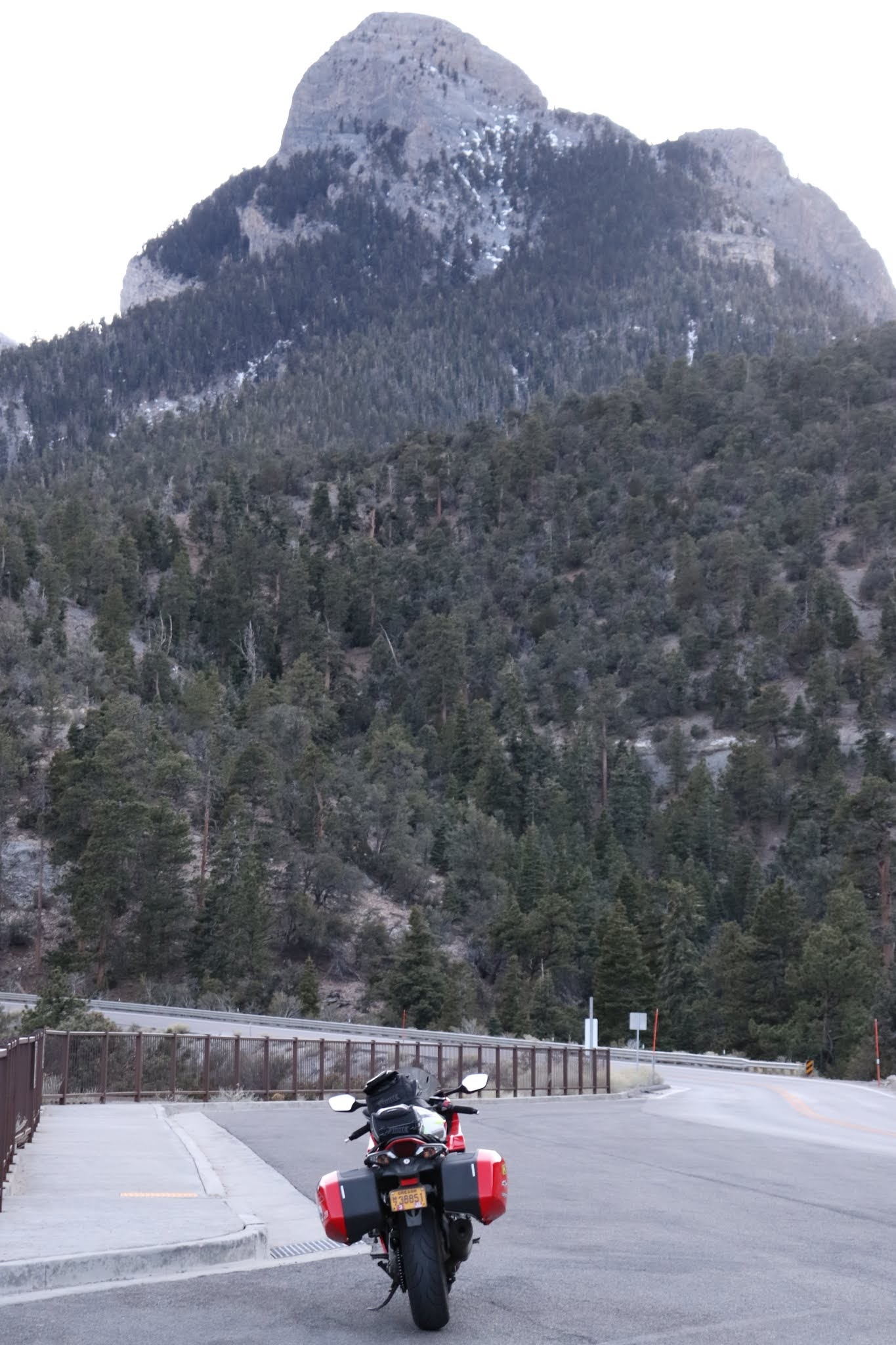
Day 4: Las Vegas to St George UT to Colorado City to Fredonia to Marble Canyon to Page to Kayenta AZ. 405 Miles. Favorite Road: 89A Fredonia to Jacob Lake to Marble Canyon to Bitter Springs.
After breakfast I slabbed out I-15 into Utah. Things started to get scenic past Hurricane (where I had dine-in lunch!). After Fredonia AZ I got a speeding ticket from an AZHP officer who wasn't wearing a mask. Seriously though why the eff was there a cop out there? 89A is so deserted. Anyways 89A up the mountain is where normally you'd turn to access the North Rim of the Grand Canyon which was already closed for the year.
This area is not without its scenic views.


Day 5: Kayenta Az to Monument Valley to Kayenta to Page to Fredonia to St. George. 325 Miles
Monument Valley was supposed to be one of the check boxes on this trip. In the morning is was low-30s and snow flurries were in the forecast. I loaded up and departed my hotel. One depressing thing about Kayenta and Navajo land was just how many PSA signs and billboards there were advising against substance abuse and domestic abuse. At the hotel there were signs advising not to give money to panhandlers and while at a scenic view pull out from the highway a truck filled with Navajo men stopped to ask for money.
Once in Monument Valley I tried to go out Monument Valley BLVD to get close to the Sentinel and Mitten mesas and ran into a roadblock. Wait, didn't we already do this in Washington several months ago?

Literally there is nothing out this road besides a closed visitor center and a few viewpoints, why close it? If I really wanted to spread a disease which I don't have why not stop at any of the houses along the way or cough on people in the grocery store in Kayenta?
Anyways I took my scenic photos from the main highway and it started snowing on me.


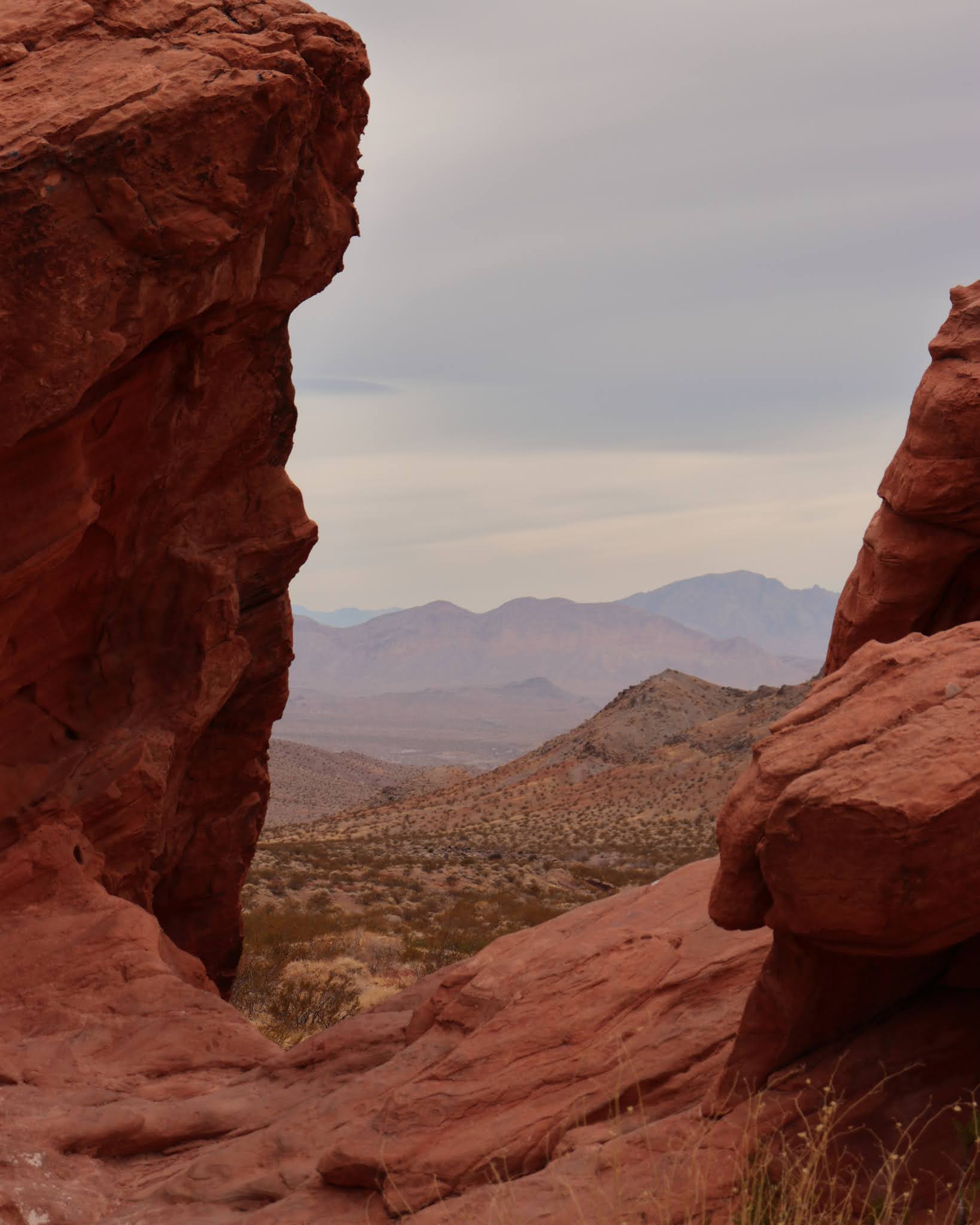
Day 6: St George to Valley of Fire State Park NV to Hoover Dam to Kingman AZ to Seligman AZ. 312 Miles. Favorite Road NV 167 through Valley of Fire State Park.
Out of SGU I slabbed it into Nevada and followed signs for the Valley of Fire State Park. The fun road starts after two cities worth of 25mph speed limits and stop signs. Once in the park the pavement is good, the roads are twisty, and at least when I was there the traffic was minimal. What traffic there was indicated the pattern of people getting out of restrictive western states (CA, OR, WA) and heading out to camp in the middle of the desert.
This rock is supposed to look like a face screaming in agony about being a rock.


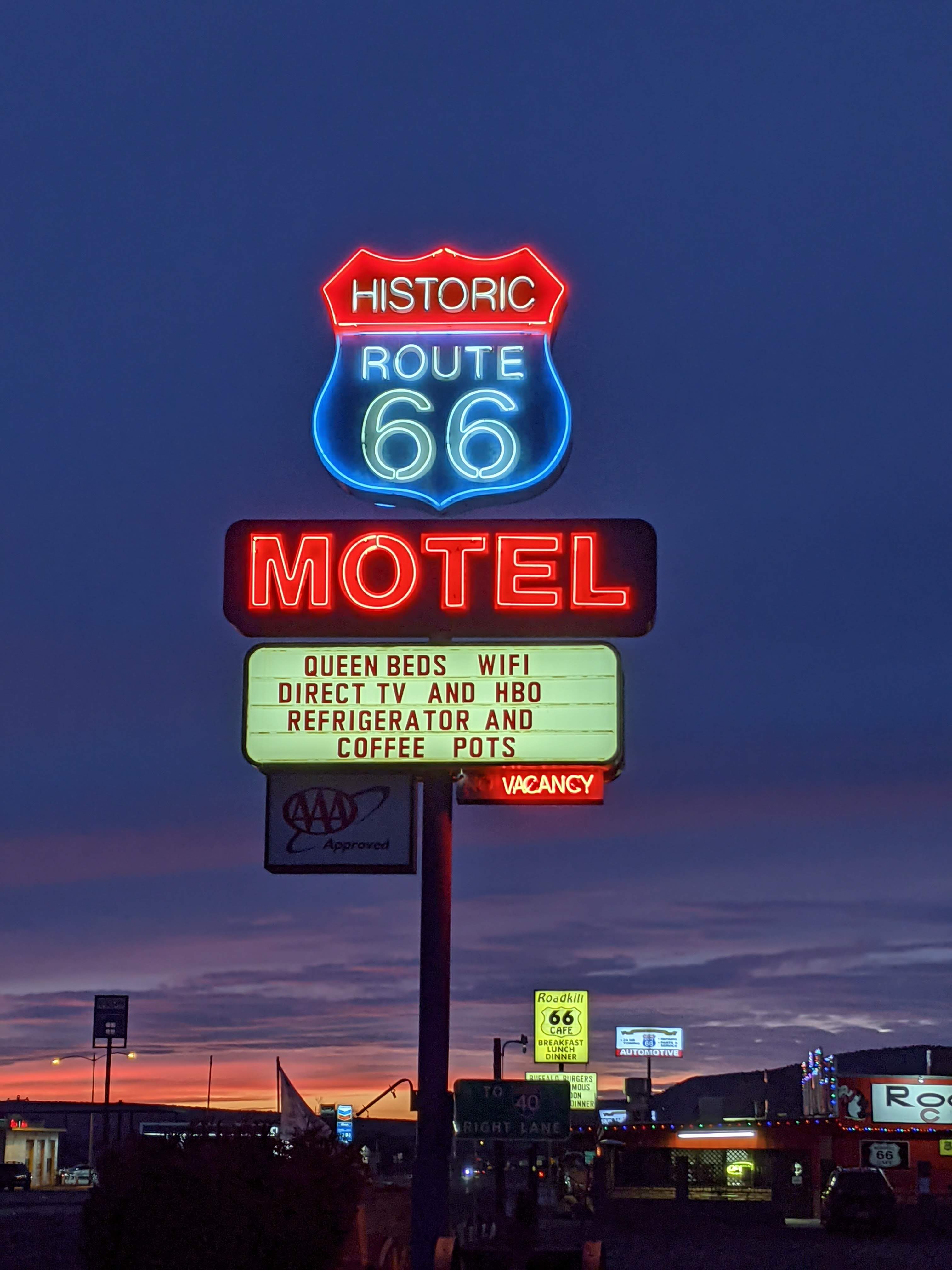


Day 7: Seligman AZ to Ash Fork to Prescott to Wilhoit to Skull Valley to Iron Springs to Jerome to Cottonwood to Camp Verde to Hwy 260/87 to Winslow AZ. 282 Miles. Favorite road: 260/87 between Camp Verde and Winslow. Honorable Mention: 89A from Prescott to Jerome and Iron Springs Road through Skull Valley.
I left Seligman after a hearty breakfast at Roadkill. My route was uneventful and mostly nice scenery down until the sprawl of Prescott. South of Prescott the road goes up and through the mountains which would be just great if the speed limit wasn't 35 and the cars were going 25. After the mountain twisties I cut off through Kirkland valley and Skull valley where the road was less busy. This road was curvy and runs along hilltops for miles but before long I ended up back in Prescott.
Outside of Prescott to the east is the road to Jerome. This is a super twisty road which would probably be better mid week. Hitting it on a Saturday with a million Californians on it was no fun. The road winds down into Jerome which is an old mining town built on the side of a steep mountain. Go look up the photos of Jerome on Google Maps, the architecture of the town is neat. Its also super touristy and every other car parked in Jerome had a California plate. Lots of refugees getting out to the Free State of Arizona and away from the pandemic gloom of their own state.
After Jerome its more spread out city for a while until the road climbs into the mountains again. This section of 260/87 between Camp Verde and Winslow is lots of fun and sparsely traveled. Its also very high elevation and there was snow beside the road.


Day 8: Winslow to Flagstaff to Glendale/Phoenix to Quartzsite AZ. 326 Miles
In the morning the weather was clear and in the low teens. I walked to the local circle K for coffee and any bit of exposed skin I had protested mightily. My dad asked how I was doing since he saw the weather forecast, and I commented that our Prudhoe Bay adventure in 2019 had prepared me mentally for riding in this kind of weather.
With my heated gear on high I set off on the slab. I planned to have beers with a friend in Phoenix and after the previous night's storm most of the interesting roads at high elevation might have been sketchy. My bike doesn't care how cold it is or apparently how high. The VFR performed just fine on the high altitude freeway to Flagstaff and then south.

In Quartzsite I got checked into my motel and explored local culture. Its pretty much just another desert town that caters to travelers. Its also a stopping point for societies' refugees on the way to/from Slab City.
Day 9: Quartzsite AZ to Joshua Tree NP to Lucerne Valley to Barstow to Weedpatch.359 miles. Trailer to Santa Nella 180 Miles. Favorite road: through Joshua Tree NP.
In the morning I took a brief walk in the desert to see some cacti up close and discovered why they call it Quartzsite. The stuff is all over the place.


Day 11: Eagle Point to Lebanon 216 miles
I got home mid afternoon and started unloading/cleaning my stuff. Total mileage on the bike:2532. Total mileage on the car: 1610. The weather mostly cooperated with my trip although to ride more of Northern Arizona and or Southern Utah I'd say October/November would work better. The concept of trailering down and starting from California works and I might do it again. There's a lot more to Arizona and Utah to explore. For that matter if the Governor of California hadn't decreed more state of emergency crap while I was down there I might have stayed and ran around the mountains east of San Diego.
There's always something for next time.
Props to you for such a long december trip! Glad Timmy didn't get stuck in the well.
ReplyDeleteA good read, thanks.
ReplyDelete